Located in the south of the high-altitude Tibetan plateau, the Lhasa Valley is one of the most stunning valleys in Tibet. The Lhasa River, also known as the River Kyichu, flows through the center of the valley to the south of the city of Lhasa, the Tibetan capital. One of the major tributaries of the Yarlung Zangbo River. It is the upper section of the Brahmaputra, the river runs in a zig-zag course, passing through the valley to enter the Yarlung Zangbo further downstream near the town of Quxu, around 10 kilometers north of Lake Yamdrok.
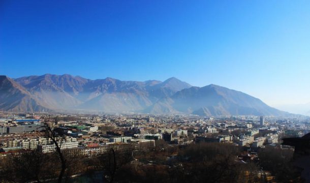
The view of Lhasa valley from Potala Palace
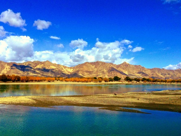
In its upper reaches, the valley is narrow, fed by the three converging rivers known as the Phak Chu, the Phongdohla Chu, and the Reting Tsangpo. Around 450 kilometers long, the Lhasa River Valley gets wider as it heads west, with one of the widest points being where the city of Lhasa is located. Surrounded by the dominant peaks of the Nyenchen Tanglha Mountains. The area around Lhasa is a marshy part of the valley, which supports a wide variety of bird life and wildfowl. Many of which are migratory birds that head for the plateau during the summer months, moving further south as the winter weather turns colder.
Lying in the valley is the Tibetan capital, built on what was once part of the marshland that was reclaimed more than 1,300 years ago. The area of the city is dominated by three natural hills, Marpori (Red Mountain), Chakpori (Iron Mountain), and Barmari (Rabbit Mountain).
Table of Contents
Formation of the Lhasa Valley
With an altitude ranging from 5,200 meters at its start to around 3,950 meters at the mouth of the river where it joins the Brahmaputra. The valley is one of the lushest and verdant valleys in Tibet. At its widest point, it is more than 5 kilometers wide, which is where the river runs into the Brahmaputra.
The valley itself was formed more than 50 million years ago. The lifting of the Eurasian tectonic plate due to the movement of the Indo-Australian plate northwards, which slid under the Eurasian plate, lifting it skywards more than 6 kilometers. Small springs formed on the newly-risen plateau. And which found small ripples between the mountains that had been pushed upwards, winding their courses between mountains and mountain ranges. Over time, these small streams joined other small streams. It was becoming fast-flowing rivers that cut huge channels through the soil and rock of the plateau, creating the valleys we see today.
In front of Potala Palace in Lhasa
The Lhasa River valley was similarly formed, starting at the confluence of two of the three tributary rivers in the Nyenchen Mountains. As the three tributary rivers converged in the narrow valleys in the midst of the mountains. At an altitude of around 4,200 meters, the river followed the naturally formed valley to the west, weaving its way among the high mountains. And eventually changing course to head west around the high spur at the point where the Reting Tsangpo River joins it.
Weather and Climate
The climate of the Lhasa Valley is variable depending on the season. Something that is unique to the Tibetan plateau due to the very high elevation. In the summer months, when the monsoon season starts, the climate is more akin to that of the humid continental climates of northern Europe. With warm sunny days interspersed with moderate to heavy rainfall, mostly in the afternoons and evenings. Temperatures range from as high as 30 degrees during the day to as low as 4-5 degrees at night.
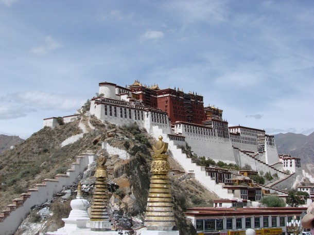
Potala Palace in Lhasa
In the winter months, the climate is more of a sub-tropical highland climate. That leaves the land dry and arid, with frosty days filled with long hours of sunshine. Temperatures in the winter can drop to as low as minus 7 degrees at night, with daytime temperatures averaging around eight degrees. For a typical high-altitude plateau climate, this is relatively warm, due to the lower altitude of the Lhasa valley. The fact that the area is more protected by the surrounding mountains.
Although Tibet is a monsoon region, it has four seasons. The spring to autumn seasons is the most popular for tourism. The weather in spring and autumn is clear and warm, with very little rain and dry days with lots of sunshine. However, the temperature differential from day to night. While still being roughly the same as the rest of the year, can leave the nights being quite cold. Nighttime temperatures range from 3 degrees to minus eight degrees. While the days are comparatively warm, ranging from 3-9 degrees.
Top Attractions of the Lhasa Valley
With it being the location of the Tibetan capital. The Lhasa Valley has a multitude of great attractions. However, the area outside the city has just as many natural attractions as the city has man-made ones.
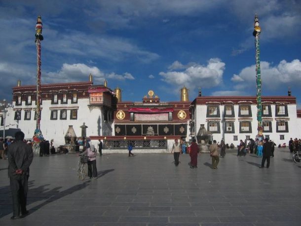
Jokhang Temple in Lhasa
Inside the city are the more popular tourist attractions, such as the Potala Palace, sitting on the top of the Red Hill, or Moburi. Built in the 16th century as the center of government in Tibet. It lies on the remains of an ancient fort that dates back to the time of the Tibetan king, Songtsen Gampo. The Jokhang Temple, the most sacred temple in Tibet. Lies in the center of the old quarter of the city. It is the end of many long pilgrim trails from across the region. Thousands of pilgrims make the journey to Lhasa every year to worship at the temple, which houses one of the oldest statues of Buddha in the world.
Famous Gelug Monasteries
The city also has more than its share of monasteries, including Drepung and Sera Monasteries, two of the main monasteries of the Gelug School of Tibetan Buddhism. Norbulingka, the former center of Tibetan governance under the 5th Dalai Lama, also lies within the city. It has one of the best and largest parks in Tibet. Known as the “lung of Lhasa” because of the huge number of trees in the park. It is one of the most beautiful places in the area to spend the day with family.
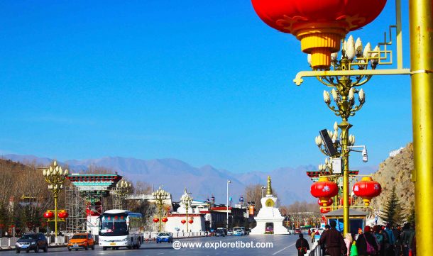
The contrast of Scene, Lhasa
The riverbank itself is one of the most popular attractions for locals and in the warmer months of summer. It is normal to see families taking a stroll along the river and picnicking on the riverbanks. With its extensive marshlands and wide river plains, the valley is one of the most beautiful examples of plateau wetlands in the world. It has become a major migratory region for some of Asia’s rarest species, including the Ruddy Shelduck and the Black-necked Crane.
The area is also famous for having the largest urban wetlands in the world, known as the Lalu Wetlands. Lying in the western part of the city, this natural wetland environment has been preserved. And kept for the migratory and indigenous species of birds and fish that live there. One of the most stunning aspects of the entire River valley, the wetlands are also a source of oxygen in this low-oxygen high-altitude region. It is the wetland areas of the valley that give Lhasa its higher oxygen content in the air during the summer months.


